


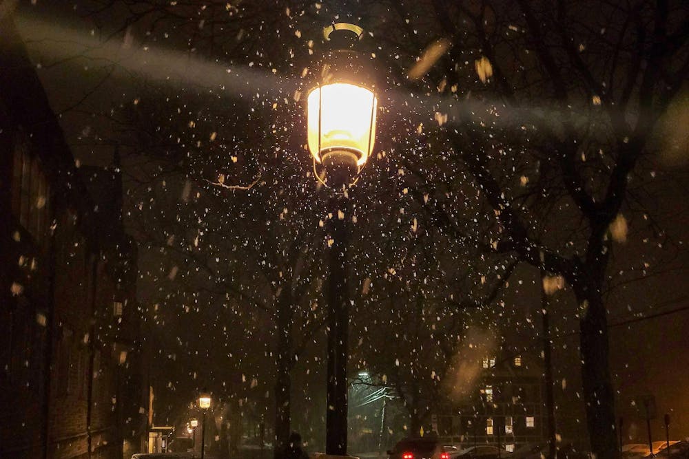
With the first snow of the winter arriving across much of the Northeast, including Princeton, we took a look at the history of the first snowfall each year in Princeton.
Weather in the town of Princeton is monitored by several weather stations in Princeton and the surrounding area. The National Oceanic and Atmospheric Association (NOAA) measures weather on Princeton’s campus via stations in town, including one near the Institute for Advanced Study, as well as stations in nearby West Windsor and Franklin Township. Weather data provided before 2008 is inconsistant.
Until 1999, the first snow also brought with it the Nude Olympics, a campus tradition where sophomores congregated in Holder Courtyard to participate in naked athletic events. The tradition was eventually banned due to a combination of spectators bringing cameras to the event and participants drinking to excess, both of which posed a threat to student safety. While the Nude Olympics no longer exists, the first snow still provides the opportunity for students to engage in winter activities.
The first snow of the season is defined here as the first snowfall after the fall solstice, which fell on Sept. 21 in 2023, and the first day where the snowfall metric reported by NOAA was above zero inches.
The date of first snowfall has generally come later and later on into the winter as time progresses. In the past three years, the first snowfall has come after Jan. 1, whereas in the 2011–2012 winter, the first snow came late in October. Since 2008, the first snow has typically come sometime in December.
According to Weather Underground, the earliest first measurable snow — meaning the first day where it snowed more than 0.1 inches — was on Oct. 10, 1979 for Philadelphia, and Oct. 15, 1876 for New York City. As of October 2023, the 30-year average of the first snowfall in Princeton was in December.

NOAA tracks two measurements of snow yield: snowfall and snow depth. According to the National Weather Service, “Snowfall (newly fallen snow) ... is taken as soon as snow has stopped falling if possible and no more than 4 times a day.” On the other hand, snow depth is measured as the “total depth of snow on the ground,” and is “typically measured at 7 a.m.”
Overall, the first snow of the season typically yields little snowfall and snow depth: in the 2019–2020 and 2020–2021 seasons, the snow did not stick at all, yielding no snow depth. This year, the snow also failed to stick. The 2010–2011 season had the heaviest first snow, with a snow depth of 13.5 inches.
The Old Farmer's Almanac predicts higher than average precipitation and an overall “frosty, flakey, and slushy” this winter.
A previous version of this story incorrectly stated that the first snow of the 2022-23 winter occurred in February, when in fact it occurred in December. The ‘Prince’ regrets this error.
Suthi Navaratnam-Tomayko is a head Data editor for the ‘Prince.’
Please send any corrections to corrections[at]dailyprincetonian.com.
Read More

Princeton researchers deny allegations that 2004 climate paper was ‘significantly shaped’ by oil executives
Sena ChangA ProPublica and Drilled investigation alleged BP executives helped shape a widely cited 2004 Princeton climate paper that popularized carbon capture, a claim the authors dispute. The report has renewed criticism of Princeton’s ties to the fossil fuel industry.
A ProPublica and Drilled investigation alleged BP executives helped shape a widely cited 2004 Princeton climate paper that popularized carbon capture, a claim the authors dispute. The report has renewed criticism of Princeton’s ties to the fossil fuel industry.

New data and AI unit quietly absorbs five research units, costing survey research director his job
Nico David-FoxEdward Freeland, Princeton’s survey research director, lost his job when the University folded his center into a broader push to consolidate its data and AI efforts. Some faculty say the reorganization was handled with little transparency or consultation.
Edward Freeland, Princeton’s survey research director, lost his job when the University folded his center into a broader push to consolidate its data and AI efforts. Some faculty say the reorganization was handled with little transparency or consultation.
Undergraduate cyclist struck by University employee sues for damages
Haeon LeeThe student, who was seriously injured, is suing the University, the employee, and the owner of the vehicle for damages.
The student, who was seriously injured, is suing the University, the employee, and the owner of the vehicle for damages.